Navigating the complexities of urban public transportation can be a daunting task, especially when faced with unfamiliar routes, schedules, and potential delays. While traditional map applications provide basic transit information, they often fall short in delivering the depth of insight required for efficient travel planning. Enter NextThere, an innovative application designed to revolutionize the public transit experience by offering comprehensive, real-time data and analytics tailored to both tourists and daily commuters.
A Comprehensive Solution for Public Transit Navigation
NextThere is not merely another transit app; it is a meticulously crafted tool that addresses the common pain points associated with public transportation. By integrating real-time vehicle tracking, historical performance data, and user-friendly features, NextThere empowers users to make informed decisions, thereby enhancing their overall transit experience.
Key Features and Enhancements
The latest iteration of NextThere, version 4.1, introduces a suite of features designed to provide users with a richer and more intuitive navigation experience:
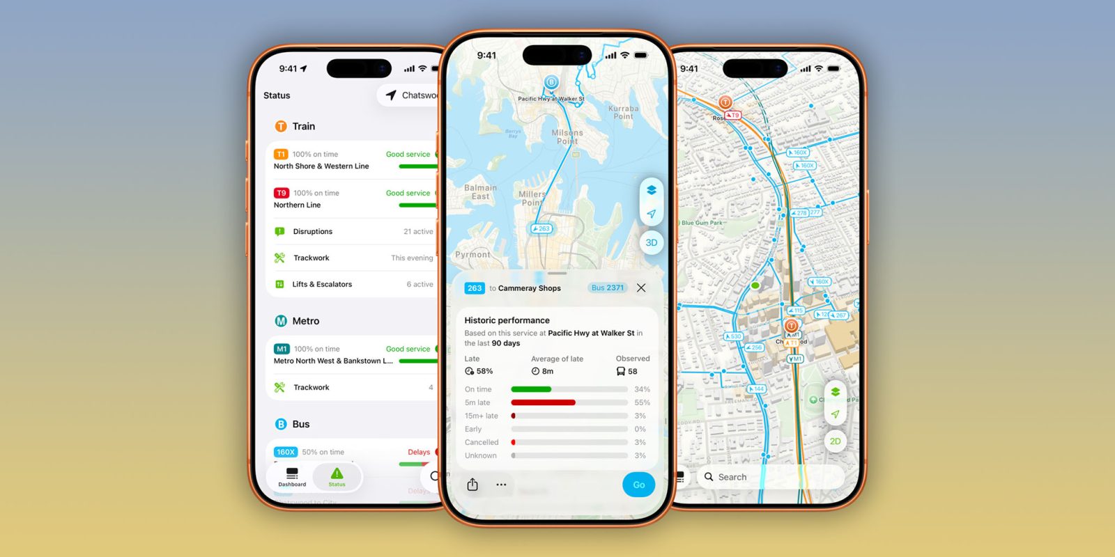
– Departure Analytics: This feature offers users detailed insights into the punctuality and reliability of specific routes. By analyzing historical data, NextThere presents on-time performance metrics and average delay times, enabling users to anticipate potential issues and plan accordingly.
– Real-Time Vehicle Mapping: Users can visualize the exact locations of buses and trains in real-time. This dynamic mapping not only displays current vehicle positions but also provides detailed traces of individual vehicles, highlighting areas where they may have slowed down or encountered traffic congestion. Such granular information is invaluable for understanding route efficiency and identifying potential bottlenecks.
– Enhanced User Interface: The app’s interface has undergone significant improvements to ensure a seamless and intuitive user experience. The design prioritizes clarity and ease of use, allowing users to access critical information swiftly and without confusion.
Expanded Geographic Coverage
Originally focused on Australia and New Zealand, NextThere has broadened its reach to include select regions in the United States and Canada. This expansion encompasses major metropolitan areas such as New York, Los Angeles, North Carolina, Boston, Hawaii, Chicago, the San Francisco Bay Area, Portland, and Washington state, as well as Ontario in Canada. While the app does not yet cover every U.S. city with public transit systems—omitting locations like Atlanta, Washington D.C., and Philadelphia—the developers have prioritized depth over breadth. By focusing on delivering detailed and accurate information for each supported city, NextThere ensures a high-quality user experience tailored to the unique characteristics of each transit system.
Real-Time Vehicle Tracking and Historical Data
One of NextThere’s standout features is its real-time vehicle tracking capability. Users can observe the movement of buses and trains along their routes, providing a clear picture of current transit conditions. Additionally, the app offers detailed traces for individual vehicles, illustrating where they have slowed down or encountered delays. This level of detail is particularly beneficial for users seeking to understand the nuances of their chosen routes.
Complementing the real-time data, NextThere provides comprehensive historical performance metrics. By analyzing past data, the app offers insights into the reliability and punctuality of specific routes. This information is invaluable for both tourists unfamiliar with a city’s transit system and regular commuters aiming to optimize their daily travel plans.
Integration with iOS Features
To enhance user engagement and accessibility, NextThere integrates seamlessly with various iOS features:
– Widgets: Users can add NextThere widgets to their home screens, allowing for quick access to real-time transit information without opening the app.
– Live Activities: This feature provides ongoing updates about transit conditions directly on the lock screen, ensuring users remain informed about their routes in real-time.
– Real-Time Notifications: NextThere sends timely alerts about delays, service changes, or other pertinent transit information, enabling users to adjust their plans proactively.
Accessibility and Pricing
NextThere is available for free on the App Store and is compatible with iPhone, iPad, and Apple Watch devices running iOS 15.6 and later. For users seeking an enhanced experience, NextThere Pro offers additional features such as detailed vehicle traces, comprehensive historical performance data, and advanced notifications. The Pro version is available through subscription plans priced at $1.99 per month or $12.99 per year for individuals, and $19.99 per year for families.
In addition to the mobile application, NextThere offers a web app that allows users to quickly check real-time arrival information from any device with internet access.
Conclusion
NextThere stands out as a robust and user-centric solution for navigating public transportation systems. By combining real-time tracking, historical analytics, and seamless integration with iOS features, the app addresses the common challenges faced by transit users. Whether you’re a tourist exploring a new city or a daily commuter seeking to optimize your journey, NextThere provides the tools and insights necessary for a more efficient and informed transit experience.