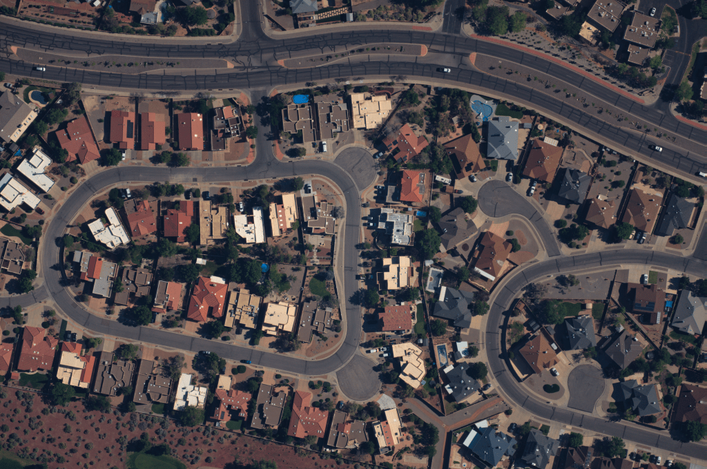
Near Space Labs, a pioneering geospatial data and Earth observation company, has successfully raised $20 million in a Series B funding round. This investment aims to enhance the deployment of their innovative Swift robots—autonomous, high-altitude imaging platforms that capture ultra-high-resolution images from the stratosphere.
Innovative Imaging Technology
The Swift robots are designed to operate at altitudes between 60,000 and 85,000 feet, significantly higher than commercial flights. Utilizing helium balloons for ascent and atmospheric currents for navigation, these robots can capture detailed images with a resolution of 7 centimeters per pixel. Each flight covers an area of up to 1,000 square kilometers, equivalent to the size of New York City’s five boroughs. This capability allows for comprehensive monitoring of urban and rural landscapes, infrastructure, and environmental changes.
Strategic Funding and Expansion
The recent funding round was led by Bold Capital Partners, with participation from strategic investor USAA, as well as Climate Capital, Gaingels, River Park Ventures, and existing investors including Crosslink Capital, Third Sphere, and Draper Associates. This brings Near Space Labs’ total funding to over $40 million, following a $13 million Series A round in 2021.
The capital infusion will be utilized to scale operations, expand the Swift fleet, and enhance data processing capabilities. Near Space Labs plans to extend its coverage beyond the top 100 most populous U.S. cities, aiming for nationwide deployment and future global expansion.
Applications Across Industries
Near Space Labs’ high-resolution imagery serves a diverse range of industries:
– Insurance: Facilitates rapid assessment of property damage following natural disasters, enabling quicker claims processing and more accurate risk evaluations.
– Urban Planning: Provides detailed, up-to-date imagery to assist in infrastructure development, zoning, and land-use planning.
– Environmental Monitoring: Supports conservation efforts by tracking changes in natural habitats, deforestation, and pollution levels.
– Disaster Response: Offers real-time data to aid emergency services in assessing damage and coordinating relief efforts.
Environmental Commitment
A notable aspect of the Swift technology is its zero-emission operation. By utilizing weather balloons and atmospheric currents, the system minimizes environmental impact compared to traditional aerial imaging methods that rely on fuel-powered aircraft.
Leadership and Vision
Co-founded by CEO Rema Matevosyan, CTO Ignasi Lluch, and Chief Engineer Albert Caubet, Near Space Labs is committed to democratizing access to high-quality Earth imagery. The leadership team’s diverse backgrounds in mathematics, aerospace engineering, and physics have been instrumental in developing and advancing the Swift technology.
Future Prospects
With the new funding, Near Space Labs is poised to enhance its technological capabilities, increase the frequency and coverage of its imaging services, and explore new markets. The company envisions a future where high-resolution, timely geospatial data is accessible to a broad spectrum of users, empowering informed decision-making across various sectors.


